




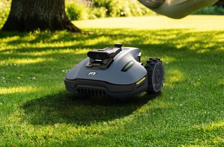
There can be tens of metres of wire to bury around a lawn. One misplaced spade can cut it, and the break can be hard to find. The perimeter wire is the biggest hassle with traditional robot mowers. A robot lawn mower with GPS does away with the perimeter wire. You set the mowing zones in an app, without laying a cable around the lawn.
GPS robot lawn mowers vary considerably in how they navigate and how well they work in different gardens. This guide explains what a GPS robot lawn mower is, how it works without a perimeter wire and how to tell whether it suits your garden.
What is a GPS robot lawn mower?
A GPS robot lawn mower cuts the grass on its own and uses satellite signals to work out where it is. It follows the garden boundaries saved on a virtual map you create in the app, so there is no perimeter wire to lay.
Some robot lawn mowers use GPS for theft tracking or to help plan where to mow. These models still rely on a perimeter wire to mark the mowing area. In this guide, a GPS robot lawn mower uses satellite positioning to mow within virtual boundaries.
How does a GPS robot lawn mower work?
The mower works out its position, then cuts the lawn strip by strip, following the map you created in the app.
To determine its position, the mower picks up signals from several satellite systems at once, such as GPS, BeiDou, Galileo and GLONASS. These are collectively known as global navigation satellite systems (GNSS). On their own, the signals can place the mower several metres from its actual position, with larger errors near the house or under trees. That level of accuracy may be enough for sat nav in a car. On a lawn, it could send the mower into a flower bed or leave a strip of grass along the edge uncut.
Most models use real-time kinematic (RTK) positioning to correct this error. A fixed reference station receives the same satellite signals and provides a steady stream of correction data. The mower can get these corrections from a station in the garden or over the internet through a network RTK service (NetRTK). With a clear view of the sky, the positioning error can drop to 1–2 cm.
You may see these models called RTK robot lawn mowers, GPS robot lawn mowers without perimeter wire or simply wire-free robot lawn mowers.
What makes up the system?
| Component | What it does |
|---|---|
| Mower | Receives satellite signals and correction data, calculates its position and cuts the grass. |
| Reference station (optional with network RTK) | Sits in a fixed position in the garden and sends correction data to the mower. It usually shares a power supply with the charging station. |
| Charging station | Recharges the mower when the battery runs low or the mower has finished cutting. |
| Mobile app | Lets you create the map, define mowing zones, schedule cuts and check the mower’s status. |
How to set up a GPS robot lawn mower in four steps
- Install the reference station if you are using local RTK. Choose an open spot away from walls, trees, large windows and metal objects. You can mount it on a wall or the roof if needed. Keep it in the same position once installed, as moving it usually means remapping the garden.
- Map the garden. Use the app to steer the mower around the edges until you are back at the starting point. Some models can detect the boundaries themselves. If the grass is long, cut it first.
- Define the zones. Mark the areas to mow, the no-go zones, such as vegetable patches, ponds and flower beds, and the routes between separate lawns.
- Start mowing. The mower cuts in parallel strips, and you can often change the direction in the app. It returns to charge on its own and picks up where it left off. Some models also pause in the rain.
GPS robot lawn mowers work on the same basic principle, but they differ in how they apply it.
Types of GPS robot lawn mowers
The GPS robot lawn mowers covered here use satellite positioning corrected by RTK. You can group them by where the correction data comes from and by which additional sensors help them understand their surroundings. Each model fits into both groups. For example, a mower might combine network RTK with vision.
1. By source of RTK correction data
- RTK with a reference station. A station in your garden sends correction data directly to the mower. This set-up can run without an internet connection. The station needs an open spot and a power supply. Once it is in place, leave it there, as moving it usually means making a new map.
- Network RTK. The mower receives corrections over 4G or Wi-Fi from a provider’s network of reference stations. There is no station to install in your garden, but you need a stable connection across the lawn and service coverage in your area. Some brands charge a subscription. A few models support both methods.
2. By additional sensors
| Type | How it works | Best suited to | Limitations |
|---|---|---|---|
| RTK only | Satellite positioning with RTK corrections | Open lawn with few trees | Less accurate under trees and near walls, with limited obstacle detection |
| RTK + vision | Satellite positioning and a camera | Family garden with a few trees and obstacles | Less effective in low light |
| RTK + LiDAR | Satellite positioning and LiDAR | Garden with trees or close to buildings | Measures the shape of objects but has limited ability to identify them |
| RTK + LiDAR + vision | Satellite positioning, LiDAR and a camera | Garden with many trees and a complex layout | Usually more expensive |
- RTK only. This is the simplest option. With a clear view of the sky, the mower follows its map precisely. Under a large tree or next to a wall, the signal is partly blocked and accuracy drops. The mower mainly relies on basic sensors that detect bumps or lifting. Some models add ultrasonic sensors or radar, but their ability to recognise objects is still limited.
- RTK + vision. A camera can help the mower recognise and steer around toys, pets or garden furniture. It also helps the mower work out its position when the satellite signal weakens. This is currently the most common configuration, though it works less well in low light.
- RTK + LiDAR. LiDAR uses a laser to measure distances and builds a three-dimensional picture of the surroundings. It can detect obstacles by day or night and help the mower navigate where the satellite signal is weak. It can tell where an object is and how big it is, though it may struggle to identify what it is.
- RTK + LiDAR + vision. This combines the strengths of the previous two configurations. Satellite positioning tells the mower where it is on the map, LiDAR measures the space around it and the camera identifies objects. This is generally the most dependable option for a garden with lots of trees and a complex layout, but it is usually the most expensive.
Buying tip. Start with your garden when you compare specifications. On a flat, open lawn, LiDAR and vision make little difference to positioning, so the extra cost mainly buys better obstacle avoidance. In a garden with tall trees right beside the house, an RTK-only mower may often lose track of its position.
Before buying, walk around the garden. Look for areas shaded by trees, strips along walls and places where toys or pets are often present. The more of these areas you have, the more sense a combination of technologies makes. If you have a stable connection across the lawn and prefer to skip the reference station, look for a model that supports network RTK.
Pros and cons of a GPS robot lawn mower
The main advantage is that you can skip the perimeter wire. There is no wire to bury or repair, and you can change the mowing zones in the app whenever you need to. A GPS model depends on the quality of the satellite signal and usually costs more than a wired model. See how GPS and perimeter-wire robot lawn mowers compare.
Advantages
- No wire to lay or repair. There is no trench to dig along the edge of the lawn and no break to track down.
- Change zones in minutes. Redraw mowing areas and no-go zones in the app. You can make temporary changes for newly sown grass or garden work.
- Even mowing strips. The mower follows a planned route for a more consistent finish.
- Easy to manage several lawns. The mower travels between zones along the routes you mark on the map.
- Check progress in the app. See the mower’s status and how much it has cut at any time.
Disadvantages
- Limitations vary with the sensors. RTK alone loses accuracy under trees and near walls. Vision is less effective in low light, while LiDAR has limited ability to identify what an object is.
- Each correction method has requirements. Local RTK needs a well-positioned reference station with a power supply, and the station needs to stay in place. Network RTK requires a stable connection across the lawn, service coverage and sometimes a subscription.
- Higher upfront cost. A GPS mower usually costs more than an entry-level wired model.
- The first map needs care. An inaccurately drawn boundary will affect every cut.
- Some edges still need trimming. Depending on the model, you may still need to go round with a grass trimmer.
Most of these drawbacks come down to the garden. An open lawn with reliable network coverage can get the full benefit of GPS mowing. A plot with lots of trees or hemmed in by buildings may need a mower with more sensors or a more carefully planned installation.
Is your garden suitable for a GPS robot lawn mower?
Most gardens suit a GPS robot lawn mower. The four things to check are the view of the sky, nearby buildings, the layout of the garden and, if you choose network RTK, network coverage. A difficult spot can help determine which model to choose and how to set it up.
Four things to check
- View of the sky. The mower needs a clear view of a broad area of sky to pick up satellite signals. An open lawn offers good conditions. Dense foliage on a large tree or a tall hedge can weaken the signal.
- Nearby buildings. Walls block and reflect some of the satellite signals. A narrow passage between the house and a fence or a lawn enclosed by two buildings can be particularly tricky.
- Garden layout. Check the total area, the number of separate lawns, the width of the passages between them and how steep any slopes are. Check each against the limits listed for the model.
- Network coverage (network RTK only). If you want to use network RTK without a reference station, check that the 4G or Wi-Fi signal is stable across the entire lawn, including at the far end of the garden.
Which set-up suits your garden?
| Your garden | What to look for |
|---|---|
| Open lawn with few trees | An RTK-only mower may be enough |
| A few trees, toys or pets | Look for RTK + vision |
| Lots of trees, a house close by and narrow passages | Look for RTK + LiDAR, or RTK + LiDAR + vision |
| Weak network signal at the far end of the garden | Choose a local reference station over network RTK |
A mistake to avoid
Avoid judging the view of the sky when deciduous trees are bare. Dense foliage blocks much more of the signal, so assess areas around trees as if they were in full leaf.
One or two difficult spots needn’t rule out a GPS mower. You can leave a small, heavily shaded corner off the map and cut it by hand from time to time. What matters is that most of the lawn offers good conditions.
FAQ
Can a GPS robot lawn mower work without internet access?
Yes, if it uses a local reference station in the garden. The mower receives its RTK corrections locally without an internet connection. With network RTK, the mower needs a stable 4G or Wi-Fi connection to receive the correction data.
Does a wire-free GPS robot lawn mower need any cables at all?
There is no perimeter wire to bury around the lawn. The charging station and any local reference station still need mains power. The two usually share a power supply.
Can a GPS robot lawn mower work under trees?
Yes, though dense foliage weakens the satellite signal. If your garden has lots of trees, look for a mower that combines RTK with vision or LiDAR. These sensors help the mower find its position when the signal is weak.
What happens if the mower loses its satellite signal?
It depends on the model. Some mowers carry on using other sensors, while others pause until the signal returns. If it keeps happening in the same spot, review the position of the reference station or leave that area off the map.
Do I need to remap my garden if I change the layout?
No. If you add a flower bed or extend the patio, you can edit the zones in the app. Moving the reference station, however, usually means remapping the whole garden.
Can a GPS robot lawn mower cut more than one lawn?
Yes. Mark the routes between the lawns in the app and the mower will use them without cutting along the way. Check that each route is wide enough for your model.
Conclusion
A robot lawn mower with GPS does away with the perimeter wire, the main drawback of a traditional robot mower. RTK-corrected satellite positioning lets it mow precisely, and you can adjust the mowing zones in the app whenever you need to.
The right model depends on your garden. An open lawn can get by with a simple set-up, while a lawn with lots of trees or close to the house calls for additional sensors. Decide how the mower will get its corrections, too. Use a local reference station or choose network RTK if coverage allows.
To find a GPS model that suits your garden, explore the Mammotion range of robot lawn mowers, with options designed for all kinds of gardens.

Did you like this article? Add us as a preferred source to find us more easily on Google.